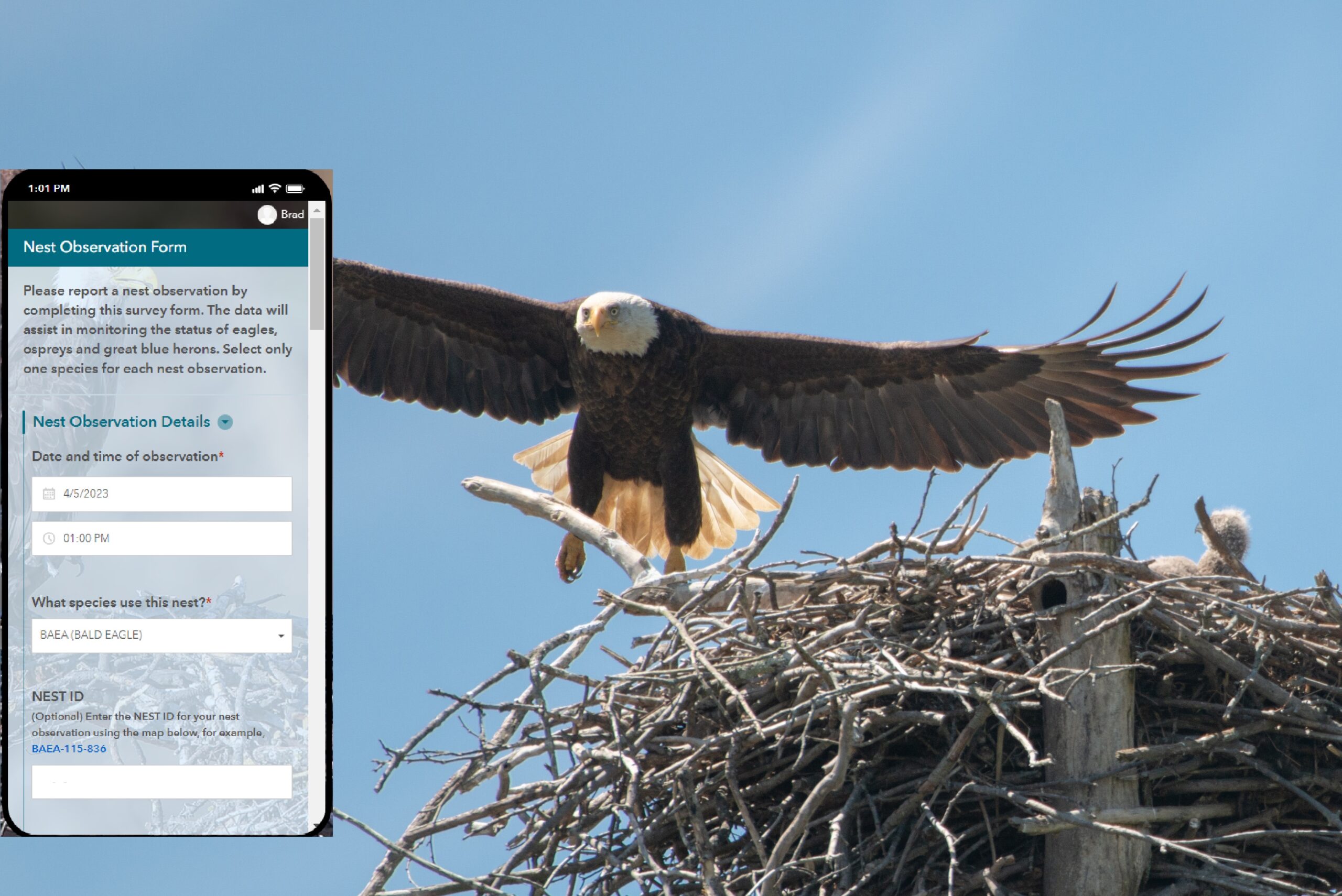
Community Mapping Network BC

Data Entry

no image no image Sensitive Habitat Inventory and Mapping (SHIM)

As resource development and human populations increase In British Columbia, pressures for all resources and services have accelerated. continued »

no image Pacific Coastal Resources Atlas for British Columbia

The Pacific Coastal Resources Atlas (PCRA) for British Columbia, Canada, was developed in response to the expressed need for an easily accessible information source that can be used by anyone with continued »

no image Mosquito Distribution and Control

Atlas currently under construction continued »

no image no image no image Kamloops–South Thompson Sustainable Community Atlas

The Kamloops-South Thompson Sustainable Community Atlas is the first project of the Kamloops-South Thompson Mapping and Capacity Partnership. continued »

no image no image no image Invasive Species - Spartina.ca

This Invasive Species Atlas is now using a new MapGuide2010 web mapping server. Keep checking back to see the progress. continued »

no image Fisheries Information Summary System Data Entry Tool

FISS data entry tools

The Fisheries Information Summary System (FISS) provides spatially represented summary level fish and fish habitat data for waterbodies throughout British Columbia and the Yukon. continued »

Syndicate content