Atlas Type: Species and Habitat Mapping
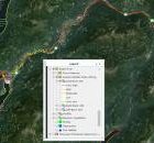
BC Wetlands Atlas
The BC Wetlands Atlas provides a citizen-science based approach to mapping wetlands in British Columbia and is an initiative of the BC Wildlife Federation’s Wetlands Education Program. The Atlas includes...
Bonaparte River Sensitive Habitat Inventory and Mapping
The Bonaparte River watershed lies within the traditional territory of the Bonaparte Indian Band, also known as the Bonaparte First Nation. The community is part of the Shuswap Nation Tribal...
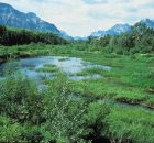
Deadman River Habitat Atlas
The purpose of the Deadman River Habitat Atlas is to provide baseline information for future decision-making about proposed shoreline developments and a detailed accounting of existing shoreline development. The project...
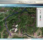
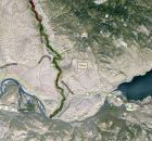
Eagle River Watershed Atlas
The purpose of the Eagle River Habitat Atlas is to provide baseline information for future decision-making about proposed shoreline developments and a detailed accounting of existing habitat condition. The project...
Fisheries Information Summary System Data Entry Tool
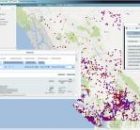
The Fisheries Information Summary System (FISS)provides spatially represented summary level fish and fish habitat data for waterbodies throughout British Columbia and the Yukon. The information is in database format and...
Forage Fish Atlas and Data Management System

The ecosystem role of forage fish and the need to protect their critical spawning and rearing habitats requires recognition and public attention. The BC Shore Spawners Alliance is an alliance...
Foreshore Integrated Management Planning Atlas

The Columbia Basin Water Hub acknowledges that the data stored on this web atlas is collected from the unceded traditional territories of the Ktunaxa, Lheidli T’enneh, Secwepemc, Sinixt and Syilx...
Fraser Valley Watersheds Atlas
The Fraser Valley Watersheds Atlas is under construction and will be providing many new layers of information in the coming months. The The Fraser Valley Regional District (FVRD) is working...
Georgia Basin Habitat Atlas
The Georgia Basin Habitat Atlas will provide up-to-date habitat information to planners, developers, governments, First Nations, community organizations, businesses and the general public. Many individuals and partners are acknowledged for...
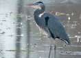
Great Blue Heron (GBHE) Management Team