Community Mapping Network Logo
AIP – BC Watershed Statistics BC Marine Conservation Analysis Atlas BC NGO Conservation Lands Atlas BC Wetlands Atlas Bulkley-Nechako Regional Atlas Comox Valley Project Watershed Coquitlam River Watershed Atlas Cowichan Valley Watershed Atlas Disconnected Waters Atlas Eelgrass Bed Mapping Elk River Alliance Fisheries Information Summary System Data Entry Tool Forage Fish Atlas and Data Management System Fraser Basin Atlas Fraser Valley Watersheds Atlas FREMP – BIEAP Habitat Atlas Georgia Basin Habitat Atlas Georgia Strait Alliance Great Blue Heron (GBHE) Management Team Harrison Salmon Stronghold Restoration and Stewardship Atlas Invasive Species – Spartina.ca Kamloops–South Thompson Sustainable Community Atlas Lower Mainland Flood and Environment Atlas MOE FLNRO Regional Library Catalogue – South Coast Region Nechako Watershed Health Atlas North Coast Watershed Atlas North Thompson Sustainable Watershed Atlas Okanagan Habitat Atlas Pacific Coastal Resources Atlas for British Columbia Pacific Region Contaminants Atlas Powell River Watershed Atlas Private Well Network Rivershed Society of BC Project Rivershed Rivers and Smith Salmon Inlets Atlas Sea To Sky Habitat Atlas Sensitive Ecosystems Inventory (SEI) SHIM (Sensitive Habitat Inventory and Mapping) SHIMobile Shorekeepers Atlas South Coast Cutthroat Southern Gulf Islands Stewardship Project Registry - SPR Sunshine Coast Habitat Atlas Wildlife Tree Stewardship WildResearch Nightjar Survey Yukon Fish and Fish Habitat Atlas Shuswap Watershed Mapping Project Eagle River Watershed Atlas Lower Shuswap River Mabel Lake Shuswap Lake Watershed Atlas Columbia Basin Water Hub Foreshore Integrated Management and Planning Atlas Slocan Lake Habitat Atlas Lake Windermere Area Habitat Atlas Thompson Nicola Regional Atlas Project Deadman River Habitat Atlas Bessette Creek and Salmon River Sensitive Habitat Atlas Bonaparte River Sensitive Habitat Atlas Louis Creek Sensitive Habitat Atlas Nicola Lake Habitat Atlas Cariboo Habitat Atlas Project Horsefly Lake Habitat Atlas West Arm Quesnel Lake Habitat Atlas
  • Home
  • Atlas Gallery
  • About CMN
  • Database Search
  • Useful Resources
  • Latest News
  • Funders, Sponsors & Partners
  • Links
  • Contact
  • Menu

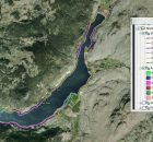
Atlas Special Tools: Georeferenced Video

Bulkley-Nechako Regional Atlas
The purpose of the Bulkley-Nechako Watershed Mapping Project is to provide baseline information for future decision-making about proposed shoreline developments and a detailed accounting of existing shoreline development. The project...
Read More
Cowichan Valley Watershed Atlas
The purpose of the Cowichan Valley Watershed Atlas is to provide baseline information for future decision-making about proposed shoreline developments and a detailed accounting of existing shoreline development. The Cowichan...
Read More
Foreshore Integrated Management Planning Atlas
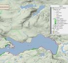
The Columbia Basin Water Hub acknowledges that the data stored on this web atlas is collected from the unceded traditional territories of the Ktunaxa, Lheidli T’enneh, Secwepemc, Sinixt and Syilx...
Read More
Kamloops–South Thompson Sustainable Community Atlas
The Kamloops-South Thompson Sustainable Community Atlas is the first project of the Kamloops-South Thompson Mapping and Capacity Partnership. the atlas supports social, economic and environmental decision making in the City...
Read More
Lake Windermere Area Habitat Atlas
The East Kootenay Integrated Lake Management Partnership (EKILMP) is a coalition of various agencies, local governments, First Nations and non-government organizations with joint responsibilities to protect lake ecosystems. The mandate...
Read More
Lower Shuswap River
Lower Shuswap River
The purpose of the Lower Shuswap Watershed Mapping Project is to provide baseline information for future decision-making about proposed shoreline developments and a detailed accounting of existing shoreline development. The...
Read More
Mabel Lake
Mabel Lake
The purpose of the Mabel Lake Watershed Mapping Project is to provide baseline information for future decision-making about proposed shoreline developments and a detailed accounting of existing shoreline development. The...
Read More
Nicola Lake Habitat Atlas
The purpose of the Nicola Lake Habitat Atlas is to provide baseline information for future decision-making about proposed shoreline developments and a detailed accounting of existing shoreline development. The project...
Read More
North Coast Watershed Atlas
The purpose of the North Coast Watershed Atlas is to provide baseline information for future decision-making about proposed shoreline and watershed developments. There are many pending development proposals.  Local governments,  Department...
Read More
Okanagan Habitat Atlas
The Okanagan Habitat Atlas is a web-based mapping tool that brings together a variety of information about natural and cultural attributes and resources of the Okanagan Basin.  Its main purpose...
Read More

Navigation

  • Home
  • Links
  • Atlas Gallery
  • Videos
  • About CMN
  • Sitemap
  • Database Search
  • User Agreement
  • Useful Resources
  • Partners
  • Latest News
  • FAQ
  • Sponsors & Partners
  • Contact

contact us

Community Mapping Network

Rob Knight, CMN Director
Email: [email protected]

Brad Mason, CMN Director
Email: [email protected]

© 2018 Community Mapping Network. All rights reserved. | Site Designed and Built by New Earth Marketing