Atlas Type: Community Mapping
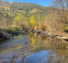
Coquitlam River Watershed Roundtable
The Coquitlam River Watershed Roundtable (CRWR) is a multi-stakeholder and Indigenous knowledge collective within the Lower Coquitlam River Watershed, whose mission is to
- Provide a forum to encourage holistic watershed...
Cowichan Valley Watershed Atlas
The purpose of the Cowichan Valley Watershed Atlas is to provide baseline information for future decision-making about proposed shoreline developments and a detailed accounting of existing shoreline development. The Cowichan...
Deadman River Habitat Atlas
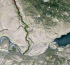
The purpose of the Deadman River Habitat Atlas is to provide baseline information for future decision-making about proposed shoreline developments and a detailed accounting of existing shoreline development. The project...
Horsefly Lake Habitat Atlas
Many of the lakes and rivers in the Cariboo Regional District have critical fish and wildlife habitat such as Quesnel and Horsefly Lakes. Development proposals are increasing along lake shores, watercourses...
Invasive Species – Spartina.ca
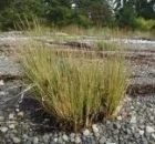
Welcome to the Invasive Species Atlas and home page for the BC Spartina Working Group, a multi-partner initiative in BC and the Pacific Coast to find and control Spartina species.
The...
Kamloops–South Thompson Sustainable Community Atlas
The Kamloops-South Thompson Sustainable Community Atlas is the first project of the Kamloops-South Thompson Mapping and Capacity Partnership. the atlas supports social, economic and environmental decision making in the City...
Lake Windermere Area Habitat Atlas
The East Kootenay Integrated Lake Management Partnership (EKILMP) is a coalition of various agencies, local governments, First Nations and non-government organizations with joint responsibilities to protect lake ecosystems. The mandate...
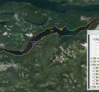
LOUIS CREEK SENSITIVE HABITAT ATLAS
Símpcwemc have utilized their territory (approximately 5 million hectares) from time immemorial and are recognized as “People of the River”. The North Thompson River watershed is largely encompassed within Simpcwúl̓ecw...
North Coast Watershed Atlas
The purpose of the North Coast Watershed Atlas is to provide baseline information for future decision-making about proposed shoreline and watershed developments. There are many pending development proposals. Local governments, Department...
North Thompson Sustainable Watershed Atlas
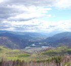
We are the North Thompson Sustainable Watershed Mapping Group (NTSWMG), composed of a cross-section of North Thompson Valley organizations and individuals that work together to foster the sharing of information...