Region: Thompson
Bessette Creek and Salmon River Sensitive Habitat Atlas
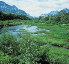
The Bessette Creek system lies within the Shuswap River watershed, a culturally significant area to First Nations. Adjacent to the Shuswap River near Enderby is the main reserve for the...
Bonaparte River Sensitive Habitat Inventory and Mapping
The Bonaparte River watershed lies within the traditional territory of the Bonaparte Indian Band, also known as the Bonaparte First Nation. The community is part of the Shuswap Nation Tribal...
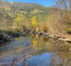
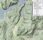
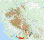
Deadman River Habitat Atlas
The purpose of the Deadman River Habitat Atlas is to provide baseline information for future decision-making about proposed shoreline developments and a detailed accounting of existing shoreline development. The project...
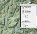
Eagle River Watershed Atlas
The purpose of the Eagle River Habitat Atlas is to provide baseline information for future decision-making about proposed shoreline developments and a detailed accounting of existing habitat condition. The project...
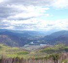
Kamloops–South Thompson Sustainable Community Atlas
The Kamloops-South Thompson Sustainable Community Atlas is the first project of the Kamloops-South Thompson Mapping and Capacity Partnership. the atlas supports social, economic and environmental decision making in the City...
LOUIS CREEK SENSITIVE HABITAT ATLAS
Símpcwemc have utilized their territory (approximately 5 million hectares) from time immemorial and are recognized as “People of the River”. The North Thompson River watershed is largely encompassed within Simpcwúl̓ecw...
Lower Shuswap River
The purpose of the Lower Shuswap Watershed Mapping Project is to provide baseline information for future decision-making about proposed shoreline developments and a detailed accounting of existing shoreline development. The...
Mabel Lake
The purpose of the Mabel Lake Watershed Mapping Project is to provide baseline information for future decision-making about proposed shoreline developments and a detailed accounting of existing shoreline development. The...
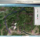
North Thompson Sustainable Watershed Atlas
We are the North Thompson Sustainable Watershed Mapping Group (NTSWMG), composed of a cross-section of North Thompson Valley organizations and individuals that work together to foster the sharing of information...
SHIM (Sensitive Habitat Inventory and Mapping)
As resource development and human populations increase In British Columbia, pressures on all resources and services have accelerated. Rapid growth has often overwhelmed the ability of local planners to manage...