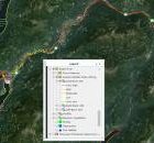
Software Version: Mapguide Open Source for PC and MAC
AIP – BC Watershed Statistics
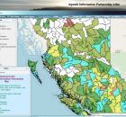
The Aquatic Information Partnership (AIP) goal is to make aquatic related information easily accessible and to create knowledge that could help conserve or maintain healthy ecosystems.
The AIP catalogue...
BC Wetlands Atlas

The BC Wetlands Atlas provides a citizen-science based approach to mapping wetlands in British Columbia and is an initiative of the BC Wildlife Federation’s Wetlands Education Program. The Atlas includes...
Bessette Creek and Salmon River Sensitive Habitat Atlas
The Bessette Creek system lies within the Shuswap River watershed, a culturally significant area to First Nations. Adjacent to the Shuswap River near Enderby is the main reserve for the...
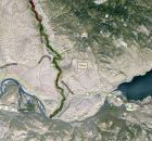
Bonaparte River Sensitive Habitat Inventory and Mapping
The Bonaparte River watershed lies within the traditional territory of the Bonaparte Indian Band, also known as the Bonaparte First Nation. The community is part of the Shuswap Nation Tribal...
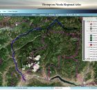
Bulkley-Nechako Regional Atlas
The purpose of the Bulkley-Nechako Watershed Mapping Project is to provide baseline information for future decision-making about proposed shoreline developments and a detailed accounting of existing shoreline development. The project...
Comox Valley Project Watershed
Comox Valley Project Watershed Society is a registered non-profit environmental society with Canadian charitable tax status focused on sensitive habitat stewardship. The organization is guided by a...
Coquitlam River Watershed Roundtable
The Coquitlam River Watershed Roundtable (CRWR) is a multi-stakeholder and Indigenous knowledge collective within the Lower Coquitlam River Watershed, whose mission is to
- Provide a forum to encourage holistic watershed...
Cowichan Valley Watershed Atlas
The purpose of the Cowichan Valley Watershed Atlas is to provide baseline information for future decision-making about proposed shoreline developments and a detailed accounting of existing shoreline development. The Cowichan...
Deadman River Habitat Atlas
The purpose of the Deadman River Habitat Atlas is to provide baseline information for future decision-making about proposed shoreline developments and a detailed accounting of existing shoreline development. The project...
Eagle River Watershed Atlas
The purpose of the Eagle River Habitat Atlas is to provide baseline information for future decision-making about proposed shoreline developments and a detailed accounting of existing habitat condition. The project...